- The data generated contributes to the analysis of river behaviour, the study of climate trends and hydrological planning
- Improvements to the network enhance flood forecasting and coordination of risk management in the Miño basin
- The RISC_PLUS project is driving the modernisation of the monitoring system with infrastructure that enables real-time monitoring of rivers and rainfall
The Portuguese Environment Agency (APA) has spearheaded the installation and modernisation of seven hydrometeorological monitoring stations in northern Portugal, as part of the European RISC_PLUS project, with the aim of strengthening the water resources monitoring and warning system and improving the ability to anticipate extreme weather events.
These measures, carried out as part of the strengthening of the Water Resources Monitoring and Warning System (SVARH), have made it possible to expand and optimise the existing network by adding new stations and upgrading existing infrastructure, ensuring greater territorial coverage and data reliability.
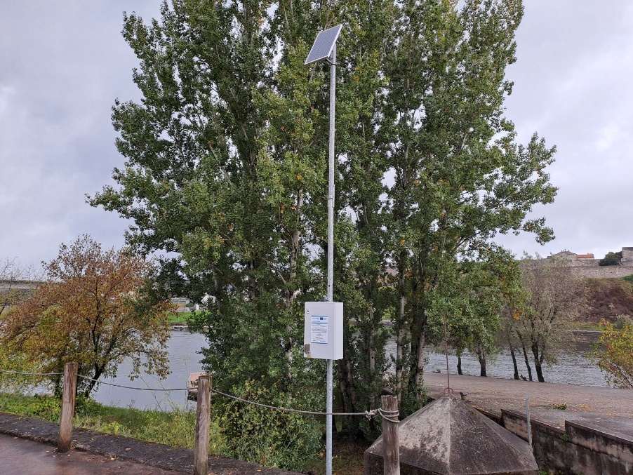
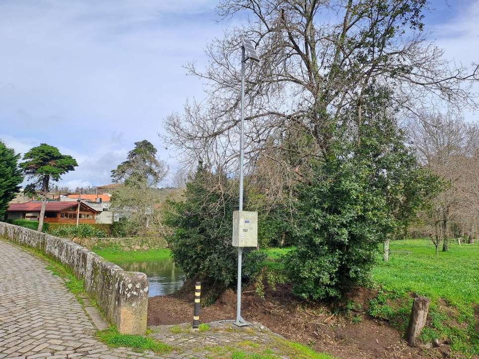
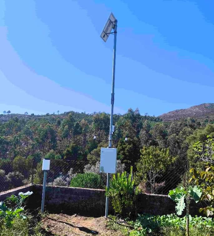
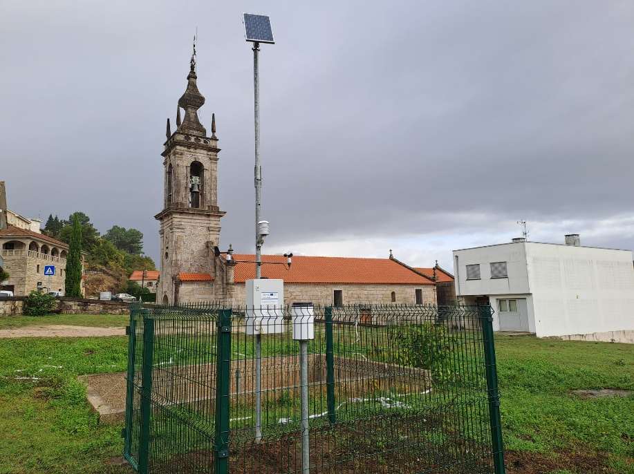
The new stations, equipped with remote transmission systems, enable the collection and transmission of real-time data on key variables such as river levels, flow rates and rainfall.
This information is essential for the early detection of hazardous situations, such as flooding or heavy rainfall, facilitating the issuance of alerts and decision-making by the relevant authorities.
The measures have included both hydrometric stations, designed to monitor rivers, and udometric and climatological stations, focused on monitoring rainfall and weather conditions.
Among the projects carried out are the Cavada hydrometric station on the River Coura and the Monção hydrometric station on the River Miño, both situated at strategic points for monitoring flood risk.
In addition, rainfall monitoring stations have been installed in Cerdeira, Extremo, Merufe and Nogueira, alongside the meteorological station in Vila Nova de Cerveira, which provides supplementary meteorological data for analysing the hydrological behaviour of the catchment.
This combination of infrastructure provides an integrated view of the basin’s hydrological behaviour, improving the interpretation of phenomena and the capacity to respond to adverse events.
The integration of these stations into the SVARH system reinforces its role as an essential tool for water resource management and civil protection, enabling faster response times and improving the effectiveness of mitigation measures.
Furthermore, the data generated contributes to the analysis of river behaviour, the study of climate trends and hydrological planning.
In a context marked by climate change, strengthening hydrometeorological monitoring is becoming a strategic element in moving towards safer, more resilient territories that are better prepared for extreme weather events.
These actions help to strengthen the monitoring network in northern Portugal and across the Miño river basin, highlighting cross-border cooperation as a key element in improving joint water resource management and risk prevention.
This project, co-funded by the European Interreg Spain–Portugal (POCTEP) programme 2021–2027, is committed to solutions based on scientific knowledge, cross-border cooperation and technological innovation, to ensure efficient and sustainable water management in a context marked by climate change.